| Home | Notes | Github |
|---|
Written: 12-Nov-2024 (Edited 26-Feb-25)
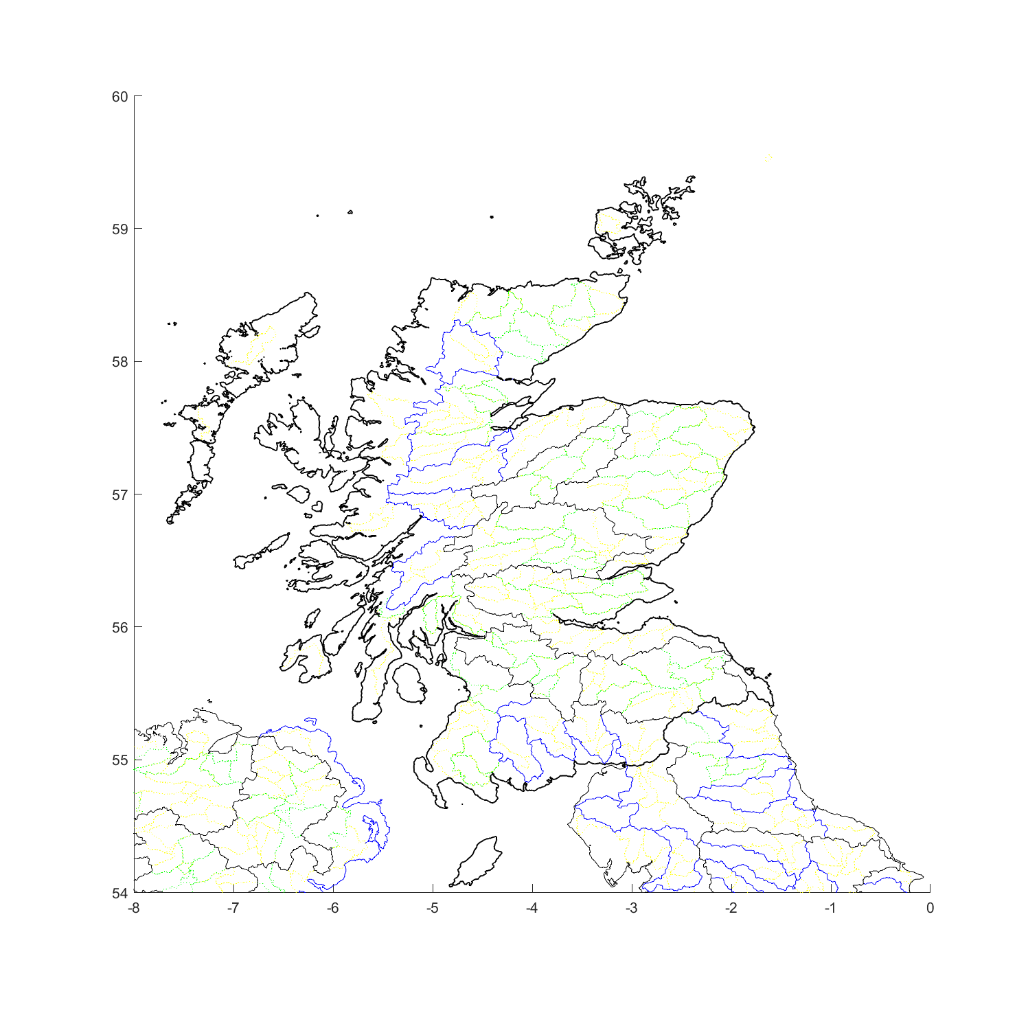
Project was to look at identifying different drainage basins in Scotland. The primary purpose of this was to overlay it on a map, and then see if there were some interesting mountains or ridges in it. Or to see if it made any mountains or ridges more interesting, which I think it did.
We’ll skip the foreplay and head strait to the maps:
Colours go from yellow, to green, to blue, to black, to thick black in increasing importance. How that importance is decided is the Pfafstetter Level, but I don’t really know what it means, nor how they decide the level for different rivers going into the sea. It doesn’t matter hugely beyond it appearing to mean bigger river -> more important.
So there are a couple interesting points, but the one that jumped out to me was the triple points. There are a couple, but the one that jumped out at me was the one between the Spey, Tay and Dee: Carn an Fhidhleir. This is a Munro! And it even has a wikipedia page1, even if it is a touch barren.
To the north-west lies the River Feshie, which flows into the Spey at Kincraig. To the north-east lies Geldie burn, which runs directly into the Dee in the middle of nowhere. To the south lies Tarf Water, which feeds the River Tilt, which feeds the River Garr, to River Tumel which (finally) feeds the River Tay. So very exiting.
There are a couple other triple basin points I thought it worth highlighting, but I’ve not yet checked to see what is doing the dividing:
[56.9356, -3.8025] Aforementioned Tay, Dee and Spey[56.8962, -4.35097] Tay, Spey and Loch/River Lochy
[57.0417, -4.625] Spey, Lochy and Ness
[55.7833,-3.44583] triple point of the Clyde, Tweed and Forth2
[55.4375, -3.5375] Annan, Clyde, and Tweed
[55.2917,-3.66667] Nith, Annan and Clyde
[56.3882,-4.37296] Earn, Tay and Forth
[56.2621, -3.41008] Earn, Eden and Leven.
Note the above coords are from the maps, so have limited precision.
Fortunately (or otherwise) it would appear to good people at hill-bagging.co.uk have already done all of this. So if you want to see their list of triples (that you can filter on) then go here.
Regardless, I got to mess with some map data, and plot some pretty maps, and mostly find what I was looking for.
So this was done - with limited intelligence - by using the HydroBASINS data from hydroSHEDS. The matlab script was highly manual (there is a reason it’s still called test.m), but is Linked. The key thing I did was to first work out which basins were inside a bounding box which equated to Scotland (and a little of Northern Ireland + England), and then plot them. It took multiple overlapping plots to do this, but given the limited scope of my interest I thought it better to go quick, dirty and highly manual than some all singing script I only used once.
So I had a couple failed attempts I wanted to touch on briefly. One was using some elevation data from here
The UK Government also puts out some good lidar data. But it was a faff to use with my current skill-set. Slightly easier to use was the elevation data from OS, which plotted out nicely:
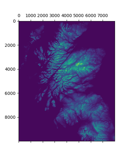
However when getting into the nitty-grity of working out how to create / simulate river basins from this date I found something. It’s annoying it came after an afternoon of data wrangling, but at least it didn’t come any later. Plus a little data wrangling is fun (plus pretty plots).
That something was a NASA presentation on River Basin Data , which in turn pointed me to HydroBASINS which is what I ended up using.
Of note is I also found out later on that some (smart) people wrote a paper doing what I thought would be an afternoons work. Well, they did a bit more, but there was more of them, and they got paid to do it3. So only a 90% failure of my ability to estimate my random side projects.